When several radars are located in one territory, additional data can be collected based on the analysis of incoming information from several radars at the same time, and taking into account their location. Our software works efficiently with large volumes of data, Big Data, because it is based on a Map-Reduce-type database suitable for these tasks.
Radars in one territory are combined into groups for which a map and room dimensions are given:
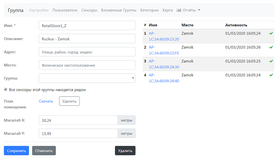
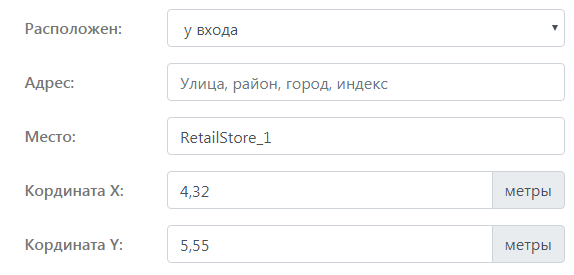
Each of the radars in the group receives additional properties:
- coordinates on the floor plan
- type of location – outside, at the entrance, in the center, at the ticket office, in the parking lot, etc.
Now, Big Data – the WNAM Radar server mechanisms allow you to build, in addition to all the previously described analytical reports, additional group reports.
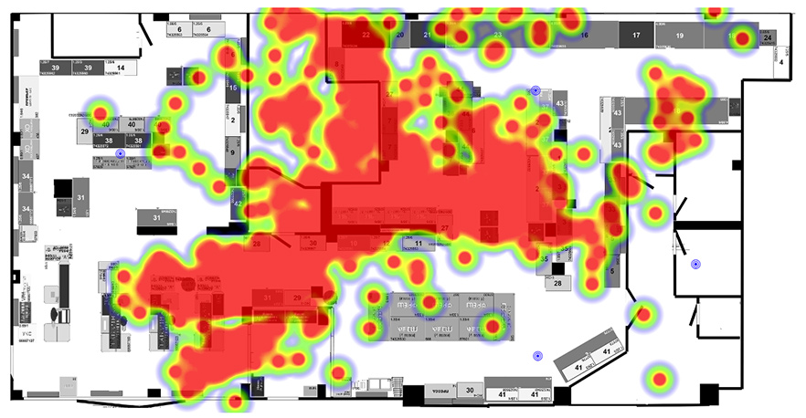
The most useful information can be provided by the “heat map” – the places of the greatest concentration of people. It is built on the basis of specialized algorithms embedded in the WNAM Radar server, including:
- mathematical model of radio signal propagation
- calculating the coordinates of a subscriber’s smartphone based on trilateration algorithms implemented through dynamic solution of linear equations systems and probabilistic models
- refinement of the coordinates of the smartphone previously trained in calibration (reference) measurements of the neural network